

Surly longing to get out of the pen for a real ride
On Labor Day I did something that I have wanted to do for a long time, since I rode out to Dog Valley for an one-night bike tour a few years ago. It occurred to me then that it would be cool to track through the 4-wheeler roads between Dog Valley and Highway 395 north of Reno, thus completing an entire circuit of Peavine Mountain northwest of Reno.
That remained on my (very long) list of things to do until, with a day off of work and Renee going hiking alone in Mt. Rose Wilderness, I decided to make a loop of Peavine.
I decided instead of going through Dog Valley first, I would go the loop the other way around, up Old Virginia Street along Highway 395 to Bordertown, then south along Long Valley Road into the maze of hills and four-wheeler roads between there and Dog Valley. My rationale was that if I had to backtrack, it would be better to be on the north side than having to make the steep climb out of Dog Valley after already having made the steep climb in.

Evans Canyon single track just before flat tire at beginning of the day
I got started at about 9:45. I went underneath McCarran Street through the Rancho San Rafael culvert and then climbed past the Basque Monument and dropped back into Evans Canyon above the Hikers Only nature trail. The single-track in the canyon is very rocky and the last time I rode there I got a flat, so I should have known, but not more than a 1/2 mile up the canyon my tire was flat.
Being a busy Sunday morning, quite a few bikers, hikers, joggers and dog walkers went past. Without fail they asked if I needed help. There was even a man walking using a golf club as a walking stick (or cane, I suppose). He asked if I had sent people for a spare tube. I told him I was waiting for my glue to dry.
From the top of the single track I climbed to the street, but as happens the street ended in a cul de sac with the Bonanza Casino and N. Virginia Street a long portage through a gully and sticker weed–crusted side hill. Still, better than backtracking so I portaged across to the parking lot of what appeared to be a vacant store-all. As I crossed, there was the loud sound of auto repair occurring in a single wide at the edge of the Mini Storage. I had an image of a gun-toter chasing me off private property as I rode by the guy leaning under his hood.
From the top of the single track I climbed to the street, but as happens the street ended in a cul de sac with the Bonanza Casino and N. Virginia Street a long portage through a gully and sticker weed–crusted side hill. Still, better than backtracking so I portaged across to the parking lot of what appeared to be a vacant store-all. As I crossed, there was the loud sound of auto repair occurring in a single wide at the edge of the Mini Storage. I had an image of a gun-toter chasing me off private property as I rode by the guy leaning under his hood.
At the top of the hill on Old Virginia Street I stopped at the 7/11 for a donut and chocolate milk. While I was paying my bill, who should appear in the convenience store but the man who'd been fixing his car down the hill. I went outside to eat and wondered if fate had conspired for me and that man's paths to cross again and again.
 Car of destiny, running for now.
From the 7/11, Old Virginia Street is a mostly quiet rolling lane along trailer parks and abandoned subdivision plots. It was very pleasant riding, not too hot, not too cold, not much traffic and generally perfect. Beyond the Red Rock exit on 395 Old Virginia Street turns to gravel, but nice wide gravel, with a steep stretch that crosses over to Cold Springs.
Across another flat valley toward Bordertown I tried unsuccessfully to short cut through the houses south of 395. There is a supposedly a way, but I couldn't find it and spent another 10 minutes riding uselessly around. I asked a motorist, but couldn't understand what he said between his cigarette drags and didn't want to pursue, so I just went by the Bordertown Casino.
Beyond the casino and freeway on-ramp, the road turns sharply south and becomes Long Valley Road. I'd been a little ways on this road in the Honda before. It is a wide valley between the northwestern slopes of Peavine to the east and the more Sierra-ey mountains to the west (the Bald Mountains on the Internet). It is a sweet valley, with real-looking ranches instead of subdivisions. The road was gravel, then inexplicably had been oiled, but the oiled section was rougher and more washboarded than the gravel section. Finally, near the head of the canyon, another road joined in and there was a single tall pine tree off the road I used for shade for a snack. I left the Surly along the road and sure enough, a pickup truck came along, stopped and started looking for the "missing biker" I stood up out of the weeds (they probably thought I was taking a nature call) and waved at them and they waved back and kept on keeping on.
From there, the road started climbing steeper and I entered national forest About halfway up a very rocky and sunny hill I started to cramp up and had to walk for a while. At a Y there was a bit of shade and stopped and took pictures and drank water. So far so good. The road, now clearly for 4-wheelers, seemed to be in pretty good shape. I took the left fork and kept going.
Around the bend, things changed. The granite soil resembled great beach sand, and well turned over by passing motorcycles, ATVs, and Jeeps. But I only had to push a few times, for short periods. This section was only 1.5 miles, but seemed a lot longer than that! The route climbed through some cool rock gardens. I stopped and climbed up the hill and self-posed for a picture:

Very meditative
The funny thing about this rock was that, once I had scrambled on top of it, it felt completely hollow inside, with only a thin outer shell that I might fall through at any time. I think it was just a trick of acoustics—or maybe it really was hollow, either way it spooked me a bit and I got down pretty much as fast as I could.
A couple more bends up the road and I hit a crossroads. Three roads lead from the crossroads, one down into the ravine, one straight ahead along the contour, and a steep one straight up the hill to the west. My best guess was that my turn was up the hill to the left, but I wanted to resist, so I probed first the downhill road. Around the corner a large SUV was parked and I could hear a family playing somewhere in the ravine below me, although I didn't see anyone. Then I rode back and up the steep hill a little ways, but then it went from really steep to insanely steep and I decided it shouldn't be the right one. So I stopped to scout. I walked across the ridge and looked down onto the middle option road, it seemed to be continuing straight south, so I decided that "needed" to be the route. Back again down the hill and through the sand and more rock gardens until I ended at a large campsite in a ravine. Oops, but a sweet campsite and stream.
I passed some motorcyclists on the way back. They told me that the road that went up the steep hill was the road I was looking for and so I went back and started climbing. It was very steep, but from the top I could see the peaks above Dog Valley.
The road continued winding up and down through the pine woodland when I came across a fence lined with signs that said: No Trespassing. Area under Video Surveillance: ARMED RESPONSE. I was quite curious what the armed response would be and who lived on this 4-wheeler track more or less in the middle of nowhere, but not quite curious enough to provoke the dreaded armed response. In fact, even stopping and reading the signs seemed creepy after a few moments and as I rode away I had that sensation that someone was watching me and kept looking back to make sure that some ATV ninja wasn't tracking me for showing just a little bit too much interest in their pot plantation or meth factory.
Another steep and rocky downhill and I came out of the forest and into Dog Valley. Coming from the other side, Dog Valley seems quite large, but coming from the north end through the pine trees it actually seems small, just a little pocket of grass in the sandy piney hills. About halfway across the valley I came across two small children, a teenager, and a large dog standing alongside the road, no car or adults to be seen. I went by them and the dog started chasing me barking. I stopped in my tracks (I've been bitten before trying to keep riding and ignore the dog) and yelled at the dog to go home, while the teenager called, "C'mon here Rodeo!" and the dog retreated, glancing back now and again as they wandered back the way they had come to who knows where.
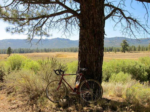
Lunch spot in a bit of shade in Dog Valley

Dog Valley grass—Bodie would've loved it!
I stopped in the shade of a single roadside pine tree and ate my lunch: a bagel sandwich with roast beef, turkey, provolone and swiss cheese and plenty of mustard. Absolutely delicious by then and now I was eager to lighten my load before the last steep climb out of Dog Valley and then the rocky downhill to Verdi.
After "lunch" (it was really probably 3:30 or 4:00 by this time), I saddled back up and made my slowly up the glaring white rocky climb out of Dog Valley. I passed a couple of 4x4s, but they slowed down and gave me plenty of room and soon enough I was in the pine trees at the top of the saddle looking back at Dog Valley. I turned on the cell phone and called Renee, who was still hiking in Mt. Rose Wilderness, so we officially missed the rib cookoff until next year.

Resting at the saddle overlooking Dog Valley
From here the downhill into Verdi loomed. It starts steep and stays steep and way too rocky for any but a little coasting. I stood to cushion my back wheel and ass against jarring and tried to relax my aching hands as much as I could, but it was a bit of a double bind. If I relaxed my hands on the brakes the bike jumped so much on rocks that I (and the Surly) took a beating, and if I stayed tight on the brakes my hands ached and cramped like crazy.
Steep and pretty long, but soon enough passed and then rejoined the ranks of cyclists between Verdi and Reno. The Surly freshly coated in dust and we luxuriated in nice smooth asphalt all the way back in to Reno.
What a great day ride from Reno.

Google map of day ride created after a couple of beers at home
No comments:
Post a Comment