 |
| Layered formation on the way down. |
Today the pups and I filled in one of my remaining blanks on my unhiked map of the Virginia Range. We hiked into the canyon directly south of Geiger Grade that leads up to the Virginia Highlands. I have been interested in this canyon for a long time, but it is a little tricky to get into (or at least I thought it was, but more about that later) due to being completely cut-off by the bottom subdivision. I partly tried to climb into it from the water tower behind Damonte Ranch high school, but that didn't quite work. Today I just parked off the side of Geiger Grade at the bottom (across from a Born Again Church parking lot full of cars, sorry folks, this is my Sunday service) and started hiking up behind the water tower that is there. It cuts behind houses, but once at the top of the little hill we were out of the subdivisions.
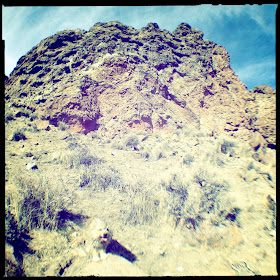
More tricky was the ice on the north-facing slope leading down to the canyon bottom. It used to be snow, but now was just treacherous ice, and even the soil was frozen and slick. Dusty had a hard time in it and I fell once before we made it to the bottom. The canyon begins with a cool layered and curved formation and then leads up through junipers. We stopped and rested at a nice sunny place above a little ravine-bottom cliff and then continued up, passing right through a small herd of horses. The canyon continually split but I stayed with the main branch until I was past the big red rock formation high up that I've always been interested in, then we started climbing, crossing into its drainage, and climbing straight toward it. It was even more impressive close up, although was a bit steep for Dusty, but he managed well, hard to believe that he's thirteen! He still goes like a pup. Finally we made it up, cutting to a saddle between two cliff faces, the red one that you can see from the canyon bottom and another gray one behind it that was riddled with cool looking caves. Up close they were both made of crumbly conglomerate, so we kept a bit of a distance.
When we finally made it to the saddle it turned out that it was basically someone's backyard. We had officially arrived in the Virginia Highlands. Whoever it was has a nice set-up a big brick stove and some benches. The gray cliff peak one had a No Trespassing sign, but not the red one, so we hiked up to the top of it. Below, we could see a nice open bare mineral spot that looked perfect for lunch, but getting down it proved a bit tricky, we had to turn back once when we came out on a cliff face. But we worked our way around and down and had lunch in a nice sunny spot.
By then it was getting fairly late and we mostly booked it back, it is so nice when those places that you want to explore turn out to be even greater than you think, and this canyon will definitely be worth a return trip!
 |
| Fireplace stumbled across at the top of the saddle. |
 |
| Coco checking out the way we've come. |
 |
| Looking south toward Geiger Grade (although that's not the road you can see) |
 |
| All smiles! |
 |
| Looking back at the cliffs. |
 |
| Bare earth deposit, I'm not sure what causes these, but they occur sporadically across the Virginia Range. |
 |
| Coco on bare earth. |
 |
| Dusty on bare earth |
 |
| The canyon. |
 |
| Layered formation again. |
 |
| Cliff face riddled with caves |
 |
| Still making it up the mountain at 13! |
 |
| Snack break spot on top of canyon-bottom cliff. |
 |
| My hiking buddies! I love them! |
 |
| Coco waiting for us slow pokes... It's a lot easier climbing on those short legs! |
 |
| Proud Dusty. |
 |
| Layered formation at the lower-end of the canyon. |
 |
| Can't go this way, running into a cliff face. |
 |
| Juniper and Sierra |
 |
| Hiding Dustry |
 |
| Another view of the cliff face with all the little caves |
 |
| Climbing |
 |
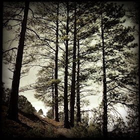
| Regular pine trees at the canyon bottom |
 |
| Looking toward the cliffs. |

No comments:
Post a Comment